Table
of Contents
Quick Reference
page
Acknowledgements
Preface to the Second Edition
Preface to the First Edition
CHAPTER 1 GPS Navigation
Works!
What GPS Navigation Can Do for
You
The GPS Receiver
The GPS Navigator
Startup: Initializing Your Receiver
Sidebar: The Other Fellow
Determining Where You Are
Summoning Help
How GPS Can Help You Return to a Man OverBoard (MOB)
Other Uses of the MOB Function
How GPS Helps You GOTO Your Dock
GPS Setup Menus
Hand-held GPS
How GPS Works
A Brief History of GPS
Where to Find Current Information on GPS
Getting More Out of Your GPS: the Next Step
CHAPTER 2 Basic GPS
Navigation
Why Use a Nautical Chart?
Reading a Nautical Chart
Scale
Latitude and Longitude
Taking a Position off a Chart
Plotting a Position on a Chart
Conventions
Direction and Magnetic Variation
Plotting an Approximate Position
Dead Reckoning (DR)
Course and Speed
Sidebar: Time, Speed, and Distance
Search and Rescue
CHAPTER 3 GPS Errors and
Insights
Precision and Accuracy
The Dockside Test
Sidebar: New GPS Accuracy Standards
Error Circles
Repeatable Accuracy and Loran C
The Workbook
Course and Speed Error
GPS and the Nautical Chart
Chart Datum
Converting from One Chart Datum to Another
Unknown Chart Datum
Sidebar: CBC Radio News: 21 Dec. 1998
Universal Transverse Mercator Maps (UTM )
GLONASS
Operating Near the Magnetic Poles
CHAPTER 4 Waypoint Navigation
Waypoints
The Destination Waypoint
Routes
MOB (Man Over Board) Revisited
Sidebar: Cecils Style of Navigation
Navigating to a Single Waypoint (GOTO)
Sidebar: Keeping a Waypoint Log
The Saved Waypoint and Waypoints Entered
by Present Position
Returning to a Saved Waypoint
Entering a Waypoint by Latitude and Longitude
Practicing With Your GPS Navigator
Default Hemisphere
Entering a Waypoint by Range and Bearing from
the Present Position
Entering a Waypoint by Loran C Time Differences (TDs)
Updating a Waypoint
En-route Functions
The Steering Diagram
Customizing the Steering Diagram
Following the Steering Diagram
Sidebar: The One in Sixty Rule
Waypoint Realization
Avoidance Waypoints
Waypoints and Chart Datum
Alarms and Alarm Zones
Anchor Watch Alarm
Sidebar: Chart Datum Conflicts
Cross Track Error (XTE) Alarms and Boundary Limits
Data Input
CHAPTER 5 Route Navigation
What Is a Route?
Creating a Route (Setting up a Route)
Verifying Waypoints in a Route
Waypoints within a Route
Starting Route Navigation
Following the Route
Arrival Radius and Waypoint Realization
Saved Routes
Selecting Waypoints
Curvilinear Legs
CHAPTER 6 Navigation
Techniques Using Position, Course, and Speed
Using Lines of Latitude and
Longitude as a Quick Reference
LOPs and Safety LOPs
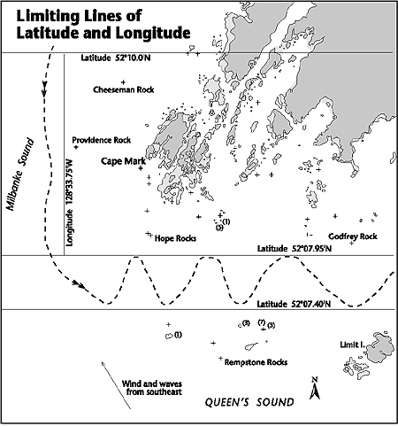
Limiting Lines of Latitude and Longitude
Determining Course Made Good (CMG) and Speed Made Good (SMG)
Sidebar: Making a Landfall
Checking Your Compass
Determining Speed Through the Water and Checking the Speed Log
Sidebar: Parallax
Route Execution Using Combined Techniques
CHAPTER 7 Waypoint and Route
NavigationAdvanced Techniques
Navigating in Tight Quarters
Determining CMG and SMG Using Waypoints
Finding the Set and Drift of the Current Using a Dead Reckoning
(DR) Waypoint
Routes and CurrentsThe Hooked Course Line
Using Cross Track Error (XTE) to Fix Position
Using Range and Bearing of a Waypoint or GOTO to Fix Position
Using a Chart of Unknown Datum
Using Waypoints to Show Military Area, International, and
Fishing Boundaries
Using Two GPS Navigators
Great Circles and Rhumb Lines
Sailing with GPS
CHAPTER 8 Enhancing Your
Understanding of GPS Accuracy
GPS Error Averaging
Ionospheric and Tropospheric Refraction
How the New GPS Accuracy Affects Navigation
Predicting Error Using Horizontal Dilution of Precision (HDOP)
Simultaneous or Multiplexing GPS
Satellite Masking
Multipath Errors
Antenna Height
The Ideal Antenna Installation
CHAPTER 9 Differential GPS (DGPS)
What Is DGPS?
DGPS Coverage
Sidebar: DGPS for Land Surveying
Another Dockside Test
Fringe Reception Areas
Update DelayHigh-Speed Navigation
Sidebar: HM Submarine Tireless
Navigational Notices
Sidebar: WAAS and NDGPS
DGPS in the British Isles
The Future of DGPS
CHAPTER 10 GPS Plotters
Simple Plotters
The GPS Sensor
Getting Used to the Display
Working With Waypoints and Event Marks
Horizontal Datum
Using Event Marks to Identify Danger Areas
Anchor Watches
Retracing a Course Line
Working with Limiting Lines
Boundaries
Chart Plotters
Sidebar: Search Patterns
The Effects of Smoothing
Perils Associated with DGPS Update Delay
CHAPTER 11 Electronic
Charting Systems
Introduction to Electronic
Charting Systems (ECS)
PC Cards
Self-Contained Systems
Electronic Charts (ECs)
The Dockside Test (Again)
COG and Heading Vectors .
The Vessel Icon
The Vessel Track
Automatic Chart Selection
Chart Insets (Plans)
Quilting
Dynamically Linked Notes
Tools
Drawing on an Electronic Chart
MOB
Entering Waypoints
GOTO
Working with Routes
Using Range Circles
Using Ship-Centered Bearings
Update Delay Issues with DGPS
Event Marks and Text Storage
Other Types of Marks
Boundaries and Guard Zones
North-up and Course-up Modes
Head-Up Mode
Radar Overlay
DR Simulation Mode
Recording Local Knowledge
Packaged Programs
Uploading Routes to a GPS Navigator
Planners
Importing and Exporting Routes
Open Navigation Format
Updating Electronic Charts
Photo Charts
Bathymetric Charts
RCDS
Shipboard PC Specifications
Sidebar: Keep Those Paper Charts!
ECS Caveat Emptor (Let the Buyer Beware)
Sidebar: Computer Crash on the Sailing Vessel Xephyr
The Future of Electronic Charting
CHAPTER 12 When GPS Fails
Types of Failure
Old Data
Cues and Clues
Causes of Failure
Protect Yourself
Other Navigational Aids
CHAPTER 13 Advanced Systems
National Marine Electronics
Association (NMEA) 0183 Standard
Autopilot Interface
ECS and Autopilot
Sidebar: GPS/Autopilot Interfaces in Small Vessels: The
Devils Work?
Radar
Radar/ARPA Integration
Sidebar: CANStar
Electronic Chart Display and Information Systems (ECDIS)
Sidebar: ECDIS on the Saint Lawrence River
APPENDICES
A.
Decimal Minutes vs. Seconds
B. GPS and DGPS Internet Sites
C. Units in Use and Conversion Factors
D. Incidents
Royal Majesty
Salty Isle
E. Sample Waypoint Log
Sample Route Log
F. Compensating for Current
Finding the Set and Drift of the Current
To Counteract the Effect of Current
G. List of Horizontal Datums
H. GPS Time and Clock Bias
I. GPS FeaturesGood and Bad
Glossary
Bibliography and References
The Workbook
Index
Fine Edge Nautical Publications
About the Authors